
Ads by Google

Nikon D90 D5000
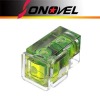
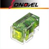
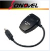
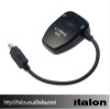
camera receiver
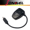
Geotag (image positioning information of pictures such as latitude, longitude can be added to the image. Correlation between pictures and maps is supported by GPS function in conjunction with software. Acquired data: Latitude, longitude, altitude, time information. Time required for satellite acquisition: Approx. 45 sec. (cold start), approx. 5 sec. (hot start). Power source: Supplied from camera body. Receiving indicators: Green blinking (GPS data recorded utilizing three satellites). Green solid(Four or more satellites detected, GPS data are more accurate). Attachment: Attaches to camera's accessory shoe or a camera strap via strap adapter.
Package: Colorbox
GPS Receiverx1
Shutter Releasex1
Hot-saling Camera GPS receiver N769-N3 for Nikon D90 D5000