

Ads by Google


Over the past twenty years, more than one million navigators around the world have put their trust in C-MAP by Jeppesen electronic charts – making their time on the water safer, easier and more enjoyable. C-MAP vector-based charts offer unrivaled navigational detail and are compatible with most brands of chart plotters and PC-based navigation systems. Exclusive value-added data, above and beyond base navigation charts, make C-MAP by Jeppesen information solutions indispensable.
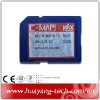
Bring your electronic charts to life with MAX, the ultimate navigator. See NavAids on your screen exactly as they appear through your pilothouse window. Get "at-a-glimpse" information about your current strength and direction. You'll even be able to view an aerial photograph of an unfamiliar inlet before you enter.
C-MAP by Jeppesen Charts